Geography of USA
Area 3,716,654 sq miles
(9,626,091 sq km)
Population 313 million
Capital Washington, D.C.
Currency US dollar
Official language English
Life expectancy 78 years
The United States of America (USA) was
founded in 1776 on principles of individual
freedom and a government voted for by the
people. It is now the most powerful country
in the world and the third most populated.
The main landmass is made up of 48 of
the country’s 50 states. The other two are
Alaska, on the northwest tip of the North
American continent, and Hawaii, an island
chain in the Pacific Ocean. The country’s
Hispanic community makes up 13 percent
of the population, and is growing rapidly.
The first African-American president,
Barack Obama, was elected in 2008.
- THE UNITED STATES is a country in North America bordered by CANADA to the north, MEXICO to the south,the PACIFIC OCEAN to the west, and the ATLANTIC OCEAN to the east. There are five predominant topographical areas within the continental United States.
The APPALACHIAN MOUNTAINS, a chain of intercon-nected low-lying mountain ranges that were carved by glacial activity, span the eastern United States from to GEORGIA.
- Aside from the mountains, the northeastern United States terrain consists of low-lying land with rocky coastline, swamps, forests, and farm-land.
The mid-Atlantic (from NEW JERSEY to VIRGINIA) re-gion includes a series of coastal inlets, farmland, andlow hills. The southeastern United States includes the Ozark and Great Smoky mountain ranges as well as hilly regions and farmland. The southernmost section of the region consists of expansive low-lying swamps.
The midwestern United States, which is predomi-nantly made up of flat plains, is divided by the MISSIS-SIPPI-Missouri-Ohio river system, which is the most expansive river system in the United States at 3,740 mi(6,020 km) and an important source of transportation for the shipping industry. The northern part of the re-gion consists of flat prairies. The region becomes in creasingly more arid moving from the north to thesouth.
The northwest is spanned by the Cascade and Alaskan mountain ranges, which includes Mount MCKINLEY, the highest point in the United States. Like the Appalachian Mountains, many of the northwestern mountains were carved by glacial activity, although they are much newer than the mountains in the east, as evidenced by their more rugged peaks. Some of the mountains, such as WASHINGTON state’s Mount St. He-lens, are the result of volcanic activity. Some of the vol-canoes, including Mount St. Helens, are still active,although there are several dormant and extinct moun-tains in the area. The region also includes rocky coast-line, and is heavily forested, supporting a thriving lumber industry.
RING OF FIRE
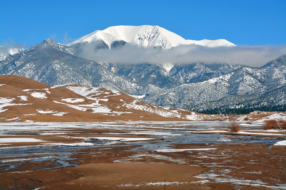
The southwestern terrain is a blend of mountain and desert, which includes the ROCKY, Santa Lucia and Sierra Nevada Mountains as well as Death Valley,which is the lowest and hottest geographic point in the United States. The southwest is also the home of the fa-mous GRAND CANYON, which was carved by the Col-orado River. Parts of southern CALIFORNIA, COLORADO,and UTAH include expansive forests. In addition, the western coast is part of the western rim of the Pacific
- Ring of fire a region of extraordinary volcanic activ-ity. Several natural fault lines along the western coast also make the region prone to earthquake activity and tsunamis.
Outside of the continental United States are the states of HAWAII and ALASKA. The state of Hawaii,which is approximately 3,000 mi (4,828 km) off the western coast of the mainland United States, consists of a chain of islands, including the five main islands—Oahu, Maui, Lanai, Kauai, and Hawaii (the big island)—and 124 smaller islands.
The island topography consists of a blend of vol-canic mountains, rainforests, and beaches. The islands of Hawaii and Maui are home to the infamous vol-canic mountains, Haleakela, a dormant volcano whose last eruption occurred in the middle of the 18th cen-tury, and Kilauea, an active volcano. The islands are also home to hilly farmlands, thick rainforests and sandy beaches, including the famous black sand beaches. The waters surrounding the islands are home to large coral reefs, atolls, and underwater volcanic craters, such as Maui’s Molokini crater, home to an array of tropical marine life.
The waters drop off quickly with several currents and riptides. During the months of November through March, the waters rise,producing some of the tallest waves in the world, a lure for surfers.
The state of Alaska consists mostly of rugged mountains terrains carved by glacial activity. The terrain renders travel by road difficult in many places and impossible in others, particularly in the arduous Alaskan winters. Transportation, particularly between the more remote villages, is largely dependent on bush pilots. During the warmer months, the Kuskokwim River serves as a shipping lane from the Bering Sea up to Bethel, Alaska. Further north, into the Yukon Delta,the terrain flattens out and consists largely of tundra.
CLIMATE
The United States climate varies by region. The South-west is generally hot and arid, with temperatures reaching over 100 degrees F (37.7 degrees C) in the desert during the summer. The dryness renders the forests of the southwest (particularly in southern Cali-fornia and Colorado) prone to large forest fires during the summer and fall.
The southwestern mountain ranges, such as the Rocky Mountains, are prone to af-ternoon thunder storms in the summer and are cold with heavy snow in the winter.
- The Great Plains of the Midwest tend toward semi-arid, increasingly hot and dry toward the south. The region home to “tornado alley,” an area subject to seasonal tornadoes. The Northwest is generally tem-perate, receiving a lot i precipitation year round. The Northeast temperatures vary widely; cold and snowy in the winter and hot and humid in the summer, with temperatures breaking 90 degrees F (32 degrees C).
Outside the continental United States, Hawaii has a tropic climate almost year-round. Winters tend to milder and rainy. Alaska has an arctic climate. In southern Alaska, temperatures may reach the 70s de-grees F (20s degrees C) during the summer. The winters usually consist of sub-freezing temperatures, snow, and reduced sunlight in the southern part of the state (com-plete darkness for months at a time in the north).
GOVERNMENT
The seat of the federal government in the United States is Washington, D.C. Designed by French architect Charles L’Enfant, the city is laid on a grid and is bor-dered along the south by the Potomac River. Washing-ton, D.C., remains the home of any sitting U.S.president for the duration of his or her four-year term.
- It is also the home of the Supreme Court, the Senate,and the House of Representatives, which make up the judicial and legislative branches of the U.S. federal gov-ernment.
The United States is divided into 50 administrative states (capitals are listed in parentheses): ALABAMA(Birmingham), Alaska (Juneau), ARIZONA (Phoenix),ARKANSAS (Little Rock), California (Sacramento), Col-orado (Denver), CONNECTICUT (Hartford), DELAWARE(Dover), FLORIDA (Tallahassee), GEORGIA (Atlanta),Hawaii (Honolulu), IDAHO (Boise), ILLINOIS (Spring-field), INDIANA (Indianapolis), IOWA (Des Moines),KANSAS (Topeka), KENTUCKY (Frankfort), LOUISIANA(Baton Rouge), Maine (Augusta), MARYLAND (Annapo-lis), MASSACHUSETTS (Boston), MICHIGAN (Lansing), MIN-NESOTA (St. Paul), MISSISSIPPI (Jackson), MISSOURI(Jefferson City), MONTANA (Helena), NEBRASKA (Lin-coln), NEVADA (Carson City), NEW JERSEY (Trenton),NEW HAMPSHIRE (Concord), NEW MEXICO (Santa Fe),NEW YORK (Albany), NORTH DAKOTA (Bismarck), OHIO(Columbus), OREGON (Salem), OKLAHOMA (Oklahoma City), PENNSYLVANIA (Harrisburg), RHODE ISLAND (Prov-idence), SOUTH CAROLINA (Columbia), SOUTH DAKOTA(Pierre), TENNESSEE (Nashville), TEXAS (Austin), UTAH(Salt Lake City), VERMONT (Montpelier), VIRGINIA(Richmond), WASHINGTON (Olympia), WEST VIRGINIA(Charleston), WISCONSIN (Madison), and WYOMING(Cheyenne).
Each state is headed by an executive branch, which includes a governor and a lieutenant governor, who are popularly elected on the same ticket every four years.
Each state also has a house of representatives, senate,and a supreme court.
In addition to the 50 states, the United States has several dependent areas: American Samoa, Baker Is-land, GUAM, Howland Island, Jarvis Island, Johnston Atoll, Kingman Reef, Midway Islands, Navassa Island,
NORTHERN MARIANA ISLANDS, Palmyra Atoll, PUERTORICO, VIRGIN ISLANDS and Wake Island. Inhabitants of some of these areas, such as American Samoa, the U.S.
Virgin Islands, and Puerto Rico, are United States citi-zens. Puerto Rico, a commonwealth of the United States, has been considered for statehood on several oc-casions, but Puerto Ricans thus far have voted to retain the island’s current status.
ECONOMY
The early American economy was an agricultural, mer-cantile economy. Although some men near larger cities were apprenticed in order to learn a trade, the majority of the settlers were farmers.
With the availability of more open land and a longer and more temperate growing season, agriculture was particularly important in the southern colonies, such as Virginia. Settlers grew and sold cash crops such as indigo, tobacco, and wood to Britain, which would process the raw materials and sell the finished product back to the United States at considerable profit.
Boston and NEW YORK CITY were the largest and most active ports, even after the Amer-ican Revolutionary War. Prior to the American Revolu-tionary War, there were many restrictions on trade thatprevented the settlers from engaging in free trade with nations other than Great Britain.
New cash crops such as sugar and cotton (follow-ing the invention of the cotton gin) created an increas-ing demand for cheap labor and created a boon for the Trans-Atlantic slave trade. It also created a demand for more cultivatable lands, and by the early 19th century,the United States began to look to expansion west-ward. This expansion led to clashes with the native tribes to whom these lands had long been home as wellas clashes with FRANCE and SPAIN, two other European powers with colonizing interests in the New World.
Industrialization began in the early 19th century with northeastern manufacturing plants, such as the textile mills of Lowell and Lawrence, Massachusetts.
Mining followed as a second major American industry,with major coal mines in Pennsylvania and gold, silver,and later zinc mines in the west.
- As it moved into modern times, the U.S. economy has come to support a diverse number of industries throughout the country. A large forestry industry exists in the Pacific Northwest. Oil drilling exists in the southwest (Texas, Oklahoma, and Nebraska) as well as in Alaska.
Agriculture still remains the predominant industry in the Midwest, which is also known as “the heart-land” and “the nation’s bread basket.” Wheat and corn are among the most common crops that are grown on a large scale, but the central United States is also home to a lot of the nation’s dairy farms. Wiscon-sin locals are known as “cheese heads” because of their state’s large cheese production. Additionally, in points both further south and west (in Texas, Oklahoma,Wyo-ming, Nebraska, and Montana) are the cattle farms that produce most of the nation’s beef.
California is home to a variety of agricultural ven-tures, including the vineyards of Napa and San Fer-nando valleys and farms that produce grapes,artichokes and other crops that thrive in a more Mediterranean climate. The California locale of Simi Valley (or Silicon Valley) is home to many of the UnitedStates premier information technology firms. Southern California is home to the bulk of the United States’thriving entertainment (film, music, and television) in-dustry.
The northeast of the country remains relatively in-dustrial, although parts of New Hampshire, western Massachusetts, Connecticut, and Vermont include smaller (mostly dairy) farms and fruit orchards. With the exception of Boston, Massachusetts, most major northeastern cities have large manufacturing plants.Boston is the host to several biotechnology firms.
Trade with foreign markets in Europe and Asia is at the heart of American industry. New York, on the East Coast, and Los Angeles, on the West Coast, are probably the nation’s two busiest ports for shipping and receiving overseas goods.
An increasing number of manufacturing and technical jobs are also being sent overseas, where corporations may find fewer restric-tions and lower labor costs and taxes.
Finally, the United States has a large tourist indus-try. In the Northeast, the beaches, museums, historic sites and fall foliage are the major draws, with the peak tourist season occurring between mid-June and early October. Beaches and the boardwalks and casinos of Atlantic City and Ocean City are a significant draw in the mid-Atlantic states.
In the South are more beaches, and golf courses,and there are several large theme parks in Florida. The peak tourist season in the South occurs February through April. In Colorado and Utah, the ski industry makes up the bulk of the tourist industry. Ski season can begin as early as late October and quite frequently runs into early May.
Additionally, Colorado receives aSignificant number of campers and hikers during the summer and early fall. The beaches of the southwest-ern coast and several other theme parks draw tourists throughout the year. Finally, Hawaii’s tropical climate draws crowds year-round.
HISTORY AND GEOGRAPHIC EXPANSION
Archaeologists speculate that the first settlers crossed into North America via a now-defunct LAND BRIDGE be-tween SIBERIA and Alaska approximately 10,000 to30,000 years ago. These people disseminated through-out North America and evolved into multiple native cultures.
The first European settlers began to arrive in what would become the United States as early as the 16th century. Spanish explorer Ponce de Leon created the first settlement in Florida in 1519. The French claimed lands in the northeast, in what is now the Great Lakes region, and in the south, including what is now Louisiana.
The French settlers established a fur trade,while the Spanish established plantations in which they initially utilized Native Americans as slaves and later brought in African slaves.
English explorer Sir Walter Raleigh and the Vir-ginia Company made the first attempt at an English settlement on Roanoke Island in 1584. The colony was a failure. Raleigh returned to England for supplies for the struggling colony, but when an expedition returned several years later, the colonists had vanished leaving only the word “Croatan” carved into a tree. The fate of the colonists remains a mystery.
The first successful English colony was established by Pilgrim separatists, who had left England because of dissent from the Anglican Church. The Pilgrims arrived at Plimouth (now called Plymouth, Massachusetts) via a ship called the Mayflower in 1620. Gradually, more English settlers arrived, peopling what would become the United States.
Some of these settlers created com-munities in Connecticut and Rhode Island in opposi-tion to the strict theocratic society set up by the Puritans. The settlements expanded, creating tensions that flared between them and the European settlers.
- There were also tensions between the colonizing pow-ers, culminating in conflicts such as the French and In-dian War of 1763.
In addition to conflicts with other European pow-ers and natives, English settlers grew increasingly dis-satisfied with the royal governance. The original 13colonies that became the United States declared their independence from Great Britain on July 4, 1776, fol-lowing rising tensions over taxation and representa-tion. This declaration of independence led to the American Revolutionary War.
The first shots of the war were fired at the Battle of Lexington, when Paul Revere took his famous ride to warn the colonists that the British army was coming. Supported by French troops, the colonial troops, who were known as the Continental Army, ultimately defeated the British and their Hessian (German) mercenaries. The American Revolutionary War officially ended in 1783, with the Treaty of Paris.
The 19th century was an age of geographic expan-sion for the United States. Vermont, Kentucky, Ten-nessee, and Ohio joined the Union within the country’s first few formative years. In 1803, the country’s thirdpresident, Thomas Jefferson engineered the purchase of the Louisiana territories (LOUISIANA PURCHASE) from France, an event that more than doubled the geographic expanse of the United States.
Realizing that he could not spare troops to defend the territory and needing more money to support his military actions in Europe, Napoleon Bonaparte decided to offer to sell to America the Louisiana Territory, an 800,000-square-mi (2,000,000-square-km) tract of land that stretched from the Mississippi River to the Rocky Mountain range to what was then the western United States.
Al-though initially suspicious of France’s motives, after nearly two years of discussion and negotiation with France, President Jefferson was elated to discover that the United States would gain not only a large amount of land, but also control of the full length of the Missis-sippi River. Meriwether Lewis, who had served as as secretary-aideto Jefferson for two years, was selected by Jefferson to lead an expedition to explore the newly acquired land. Upon accepting this appointment, Lewis wrote and asked William Clark to join him.
Once Clark had accepted the offer, the two men embarked on their exploration from what is now Hartford, Illi-nois, on May 14, 1803. LEWIS AND CLARK were joined by a crew of 45 men in order to help porter supplies and a large, armed keel boat.
The Lewis and Clark Expedition took three years and covered 3,700 mi (approximately 5,955 km)through what is now Illinois, Missouri, Kansas, Iowa,Nebraska, South Dakota, North Dakota, Montana,Idaho, Oregon, and Washington State.
MANIFEST DESTINY
This expansion brought about a sense of Manifest Des-tiny, a notion that supported westward expansion as being sanctioned by God. The western frontier was often romanticized in popular culture as a mecca of open space and wild independence as the acquisition of land continued. With both the emigration of the U.S.
- population ever more westward and the country be-coming increasingly more industrial, public interest grew in having the means to transport people and goods quickly, safely, and reliably.
By 1841, settlers moved across the northern Great Plains (including the Dakota and Kansas Territories),in what became known as the Oregon Trail. The trail ran from the borders of Missouri and Iowa, through Nebraska, Kansas, Wyoming, Idaho, and up to the border of Oregon and Washington State.
Most of the settlers moved along either by foot or in caravans of covered wagons, across wide, hostile rivers and across rocky, mountainous ledges. Approximately one in ten travelers died en route from disease, starvation, attack,or accident, but the Oregon Trail remained the best route westward.
The United States purchased Texas and surround-ing lands in 1848, adding to the growing country.
President James Polk’s announcement that gold had been discovered in the Oregon Territory heightened in-terest in westward expansion, and in 1850, California,which was also rich in gold, became the 30th state.
- The famous Comstock Lode in Nevada nine years later lured still more would-be prospectors westward and aroused interest in finding a route across the jagged peaks of the Sierra Nevada Mountains.
The lure of gold and silver in the west helped to mitigate the sectionalism and regional interests that had stalled many earlier discussions about building a railroad. The Central Pacific Railroad Company was established in 1860 and following two years of surveys and lobbying, President Abraham Lincoln and Con-gress passed the Pacific Railroad Bill, which provided financial support and land for the building of multiple railroads.
The Central Pacific and Union Pacific Railroad Companies began their separate railroad lines in 1863,with the Central Pacific beginning in California and the Union Pacific beginning in Nebraska. Construction of the railroads caused the flare of tensions between those associated with the railroads and the natives through whose lands the lines passed.
Construction of the railroads moved very slowly,sometimes only inches a day in mountainous areas where the route needed to be carved through the mountains. After years of labor issues, construction setbacks and quibbling between the two railroad companies, the Union Pacific and the Central Pacific, with their engines nose to nose, came together in 1869 to drive a golden spike, which serves as a symbolic unifi-cation of the United States.
In addition to this symbolic unification, this transcontinental railroad provided a means by which the United States could move freight and transport people, thus acting as a catalyst for the further expansion, mobilization and industrialization of the country.
The United States purchased additional territory with the Gadsden Purchase of 1853. Overall, this ex-pansion led to further tensions with the natives as set-tlers began to encroach on their lands, leading to violence on both sides. Controversy erupted over the so-called Indian problem, as there were multiple ideas of how to handle these tensions.
Some argued for the forcible assimilation of natives into western Euro-cen-tric society, believing Christianity and a written culture to be hallmarks of a civilized society. Some Native American cultures, most notably the Cherokee people,were highly successful in adopting European culture.
They developed their own system of writing based on the Cherokee language, created a school system and wore European dress.
- Through the political turmoil of the Civil War and the subsequent Reconstruction, the United States con-tinued to expand geographically. In 1867, the United States purchased Alaska from Russia, when Secretary of State William H. Seward signed an agreement with the Russian minister to the United States, BaronEdouard Stoeckl, where Russia ceded the Alaskan Ter-ritory to the United States for a sum of $7.2 million.
This much-ridiculed agreement became known as “Se-ward’s Folly,” as there was little public interest in the land. Alaska remained governed by the navy until 1884, when the Organic Act was signed, making the territory a civil and judicial district.
In 1893, the United States annexed Hawaii, under the pressure of the wealthy and powerful sugar planta-tion owners. Additionally, the islands were in a geo-graphically strategic location in terms of military and shipping. In 1959, both Alaska and Hawaii became the 49th and 50th states, respectively. As commercial air travel became more common in the mid-20th century,Hawaii became the subject of an intense marketing for tourism.
The United States has remained geographically sta-ble for decades, although there is still some speculation that Puerto Rico may one day elect to become the 51st state. Throughout its growth, the United States became a major world power and retained military presences and small commonwealths and protectorates around the globe. As it moves into the 21st century, the degree of influence the United States has around the world is the subject of some controversy.


